
Choosing your route to the Enchantments Basin
Most visitors to the Enchantments are keen to explore Enchantment Basin (sometimes called the “Core” after the permit zone it’s located in). The basin is the crown jewel of the Enchantments.
There are two routes in to the basin, departing from different trailheads. The trailheads are about 8 miles apart by road, and the trail connects them in a horseshoe shape that passes through the basin.
To reach the basin, you can choose either of these two routes:
- from Snow Lakes Trailhead: 9.5 miles and 6400 feet of ascent
- from Stuart Lake Trailhead: 5.6 miles and 4800 feet of ascent
Neither is easy. The latter may look more appealing on paper, but it goes up the infamous Aasgard Pass, which climbs 2300 feet in less than a mile. And it arrives in the upper end of the basin, which is a barren moonscape with fewer pleasant campsites than the alpine meadows of the lower basin.
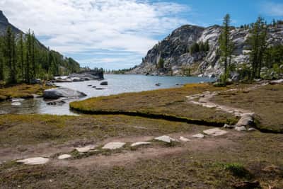
The basin itself is about 3 miles long. The upper end (nearest to Aasgard Pass and the Stuart Lake Trailhead) is about 1200 feet higher than the lower end (nearest to the Snow Lakes Trailhead).
If you wish to see the whole trail end-to-end, it’s 18 miles and either 6000 or 8000 feet of ascent (depending on which trailhead you start from).
Because permits are required to camp anywhere in the Enchantments, some people choose to thru-hike the whole trail in one day. This is extremely difficult and should not be attempted by novice hikers.
More likely, you’ll backpack the Enchantments. If you’re lucky enough to get a permit for the Core Zone you can camp in the basin. Otherwise, your best bet to see it is to snag a permit for either the Snow Lakes Zone or the Colchuck Lake Zone, and then day-hike up to the basin from your base camp.